How Emergency Streambank Stabilization Protected Our Town’s Infrastructure

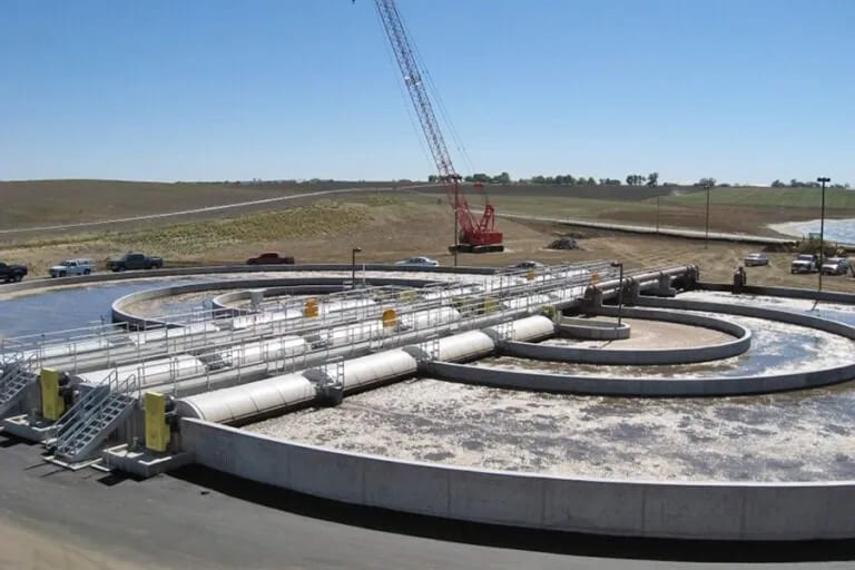
I work as the public works director for a small town nestled along a modest river in the Midwest. Our wastewater treatment plant sits near the confluence of two streams that, most years, remain calm and manageable. But two springs ago, we saw rainfall levels we hadn’t experienced in over half a century.
In just over three days, the river crested more than five feet above its usual mark. The current scoured the outer bend nearest our lagoon cells, eroding nearly 12 feet of streambank. By the time the storm subsided, a third of our eastern embankment had collapsed. What we were left with wasn’t just erosion—it was a direct threat to our entire wastewater infrastructure.
At the emergency city council meeting that week, it was clear: we couldn’t afford to wait. If another storm hit, we’d lose a treatment cell—and potentially contaminate the river. One council member said, “We need this fixed before next month, not next year.”
That’s when I called in a firm I’d worked with once before on a culvert failure. This time, I asked if they had experience with streambank stabilization design. Not only did they say yes—they had engineers who specialized in natural channel hydrology, bank armoring, and rapid deployment.
They showed up two days later with surveying gear, drone equipment, and a hydrologist in tow. What impressed me immediately was their priority: they didn’t start with what to build—they started with what the river was doing. They modeled its current velocity, its future shear stress under various storm events, and how it interacted with our riparian corridor. Then they talked about design.
Because the river curved so close to the facility, a hard-engineered solution alone wouldn’t be enough. They proposed a hybrid fix:
– Armoring the most vulnerable slope toe with interlocked rock and biodegradable geogrid
– Installing a series of rock vanes to redirect flow toward the center channel
– Regrading the bank to a stable slope and revegetating it with native, deep-rooted grasses and willows
– Using a staged construction approach to minimize site disruption and allow sequencing with weather windows
Their timeline was aggressive. So was our risk. The engineering team submitted a permit-ready design within ten days. We went out to bid, awarded the contractor, and started work within three weeks of the storm.
During construction, their staff were onsite nearly every day. They monitored turbidity, guided vane placement, and adjusted the grading plan in real time. They even recommended anchoring biodegradable logs with willow cuttings at one segment where sediment transport was higher than expected.
By the end of the second month, the toe was armored, the grading complete, and vegetation in place. Two months later, we saw another storm—less intense but still fast-moving. The new system held. No visible scouring. No slope movement. Just redirected water and a stabilized, vegetated bank.
Their work didn’t stop at installation. They provided us with a post-project monitoring template and trained our staff on visual indicators of failure or wear. We now walk the site monthly, documenting everything. So far, we haven’t needed a single adjustment.
What I appreciated most was their ability to explain every choice in plain language. When I presented the follow-up report to the city council, one member said, “That’s the first engineering report I’ve actually understood.” That meant a lot.
We’ve since extended the stabilization to two other sites on town property. Same firm, same team. The confidence they brought us wasn’t just technical—it was personal. They respected our budget, our constraints, and our urgency.
The crisis made one thing clear: streambanks don’t erode in a vacuum. They take infrastructure, ecosystems, and public trust with them. If you’re not already working with people who understand that, you’re gambling with a river that doesn’t care.
We’ve since revised our risk matrix to flag any public infrastructure within 100 feet of a streambank for early inspection. And we now require a full fluvial geomorphology assessment before any river-adjacent development is permitted.
There’s a lot I wish we’d done sooner. But there’s nothing I regret about who we brought in when it counted.